
North-Eastern Atlantic, Mediterranean and connected seas
Tsunami Information Centre


Concerns in the wider region about the possible flank collapse of Cumbre Vieja triggering a tsunami. Role of Tsunami Early Warning and Mitigation System in the region.
The La Palma volcano eruption is generating headlines. The world has been captivated by the footage and images of the volcanic eruption and flowing lava in La Palma Island, in the Canary Archipelago. Part of the Cumbre Vieja (meaning “Old Summit”) volcano's main cone is reported to have collapsed amid an increase in "effusive activity". Lava reached the sea last week, forming a huge promontory (locally named “fajana”) on La Palma coast. It is estimated that over 1,000 buildings have been affected so far by the lava flow, with 6,000 people evacuated. The Spanish Prime Minister, Pedro Sánchez, visited La Palma and promised a 206 million Euro recovery package. On the other hand, many speculate and fear a possible associated, landslide-induced tsunami risk. There are concerns in the region about the possible flank collapse of Cumbre Vieja triggering a large tsunami. Questions include what is the likelihood and size of any landslip, tsunami detection and monitoring capability in the region and what could be the likely impacts? 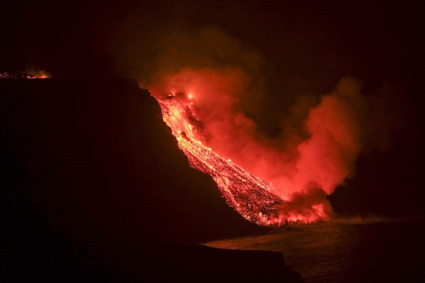
Lava has been flowing down the Cumbre Vieja volcano's western flank towards the sea since Sept 19, 2021. PHOTO: EPA-EFE.
First, it is difficult to predict a landslip that triggers a tsunami. Mercedes Ferrer and others found in 2021, historical records of geological evidence and geochronological data of at least five megatsunamis in Tenerife, Lanzarote, and Gran Canaria, triggered by island flank mega landslides, and occasionally explosive eruptions, during the last 1 million years. Additionally, Inés Galindo and others presented a study in 2021, about a tsunami that was produced by the Argaga (La Gomera) landslide in 2020. However, Carracedo and others published in 1999 and 2001 that most volcanoes in the island required longer time periods to reach a critical level and when they reached it, there were more clear evidence of a possible flank collapse. For example, the landslip in La Palma, that created the Taburiente Caldera and the Aridane Valey, occurred 560 kyr ago and took hundreds of thousands of years to reach its critical level of instability, in contrast Cumbre Vieja was only formed about 125 kyr ago.
Recently, a research study conducted by French scientists about a possible La Palma landslide induced tsunami found that in the likelihood of a maximum slide volume (i.e., 80 km3) the wave impact is high on surrounding islands and coasts, as well as on the most exposed remote coasts such as Guadeloupe, located in the path of maximum wave energy. In Europe, the study found that the wave impact is high (for specific areas in Spain and Portugal) to moderate (Atlantic French coast), and moderate to weak along the French Atlantic coast. Smaller slide volumes (i.e., 40 and 20 km3) would have moderate impacts on these remote areas. The study provides certain insights concerning potential landslide and impacts. Helène Hebert, CENALT, France, said that this new study is suggesting revising the transoceanic models following an extreme worst-case scenario in La Palma. This study employs scenario analysis of different slide volumes.
Other scientists like Professor Mauricio Gonzalez, Universidad de Cantabria, Spain cautioned that the interesting issue would be to assess whether there is actually the possibility of a collapse of the island of La Palma that could generate a macro-tsunami. Professor Miquel Canals (University of Barcelona), an expert in marine geology mentions that, in contrast to other island flanks in the Archipelago, the western flank of La Palma is not buttressed, this means that extensive magma intrusions would tend to push such flank seawards, eventually generating a large tsunami. Seafloor and sub-seafloor evidence west of La Palma documents the occurrence of giant flank landslides in the past. However, such a worst-case scenario is very unlikely to occur under the current eruptive setting, which affects a limited section of Cumbre Vieja. In any case, monitoring the evolution of the on-going eruption is critical in terms of adoption of geo-hazard prevention measures.
While the discussion continues, focus is shifted towards the tsunami early warning system for the observation and detection of a possible tsunami. The Intergovernmental Coordination Group for the North-eastern Atlantic, the Mediterranean and Connected Seas Tsunami Early Warning and Mitigation System (ICG/NEAMTWS) of the IOC/UNESCO, is the current body concerned with Tsunami early warning in the region. It was formed in response to the tragic Indian Ocean tsunami event of 26 December 2004, which caused major damage and took over 250,000 lives. The ICG/NEAMTWS consists of five accredited Tsunami Service Providers (TSPs) in France (CENALT), Italy (INGV), Greece (NOA-HL-NTWC), Portugal (IPMA) and Turkey (KOERI). The Centre d’Alerte aux Tsunamis (CENALT, France) and the Portuguese Institute for Sea and Atmosphere (IMPA, Portugal) monitor seismic activity, coastal sea level, and provide free tsunami information and services to subscribed member states within the North-eastern Atlantic region.
Dr. Denis Chang Seng, IOC UNESCO Programme Specialist and ICG/NEAMTWS Technical Secretary, pointed out that the current Tsunami Early Warning and Mitigation System (TEWS) is not technically designed or optimised for volcano-landslip induced tsunamis. These situations remain a challenge and a limitation for TEWS across the globe. This was clearly demonstrated following the collapsed into the ocean of a large portion of the southern flank of the Anak Krakatau volcano on 23 December, 2018, causing a tsunami that swept the Lampung Province of Indonesia. The event killed dozens of residents and destroyed hundreds of houses. Following the eruption, the Joint Research Center (JRC) of the European Commission, collaborated with the local institutions in Indonesia to design and implement an emergency Tsunami Warning System for the Anak Krakatau volcano based on the installation of a number of Inexpensive Devices for Sea Level Measurement (IDSLs) around the Island’s volcano. Dr. Alessandro Annunziato, (JRC, European Commission) said that they are rapidly responding to a request from the Instituto Geográfico Nacional (IGN) of Spain for the provision of a new emergency IDSL, to be installed in the harbour of Tazacorte, on the western coast of La Palma Island, downhill of Cumbre Vieja’s on-going volcanic eruption. The objective is to monitor the sea level as close as possible to the volcanic source. The installation will take place after 20 October. The IDSL data logger software include routines that analyze the signals in real time and send them as messages/information about the detected wave anomalies to a list of prescribed users (SMS and email).
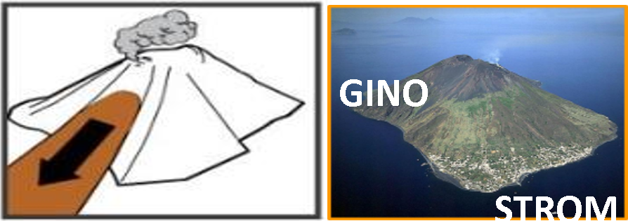
Stromboli, Italy, is also a good example to highlight volcanic induced tsunami events and experiences in the Mediterranean region. On 30 December, 2002, a part of the Sciara del Fuoco collapsed due to critical volcanic activity and associated lava flow, causing a landslide of 18 million cubic meters of material. Seismic wave recordings showed that the detachment of the wall occurred in two separate close phases, in fact, the landslide was first triggered in the submerged part of the Sciara and then spread to the surface part. The underwater landslide generated a sequence of tsunami waves that in a very short time intersected the whole island of Stromboli, the Northern part of the island of Panarea and eventually reached the other islands of the Eolian Archipelago, along the Messina and Calabria coasts. The maximum height reached by the tsunami wave on the coast, reported during the monitoring phase, was above 10m in many parts of the island of Stromboli. Presently, public authorities in Stromboli have developed designated mapped hazard zones, public displays of tsunami information, community-based tsunami evacuation maps, as well as outreach and public education materials. Tsunami hazards are fully addressed in the Community’s Emergency Operation Plan (EOP).
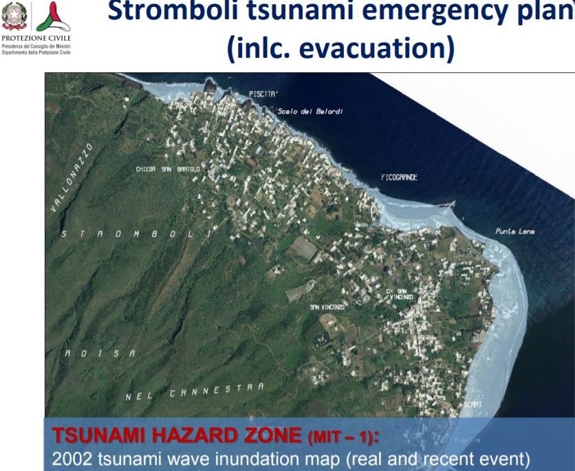
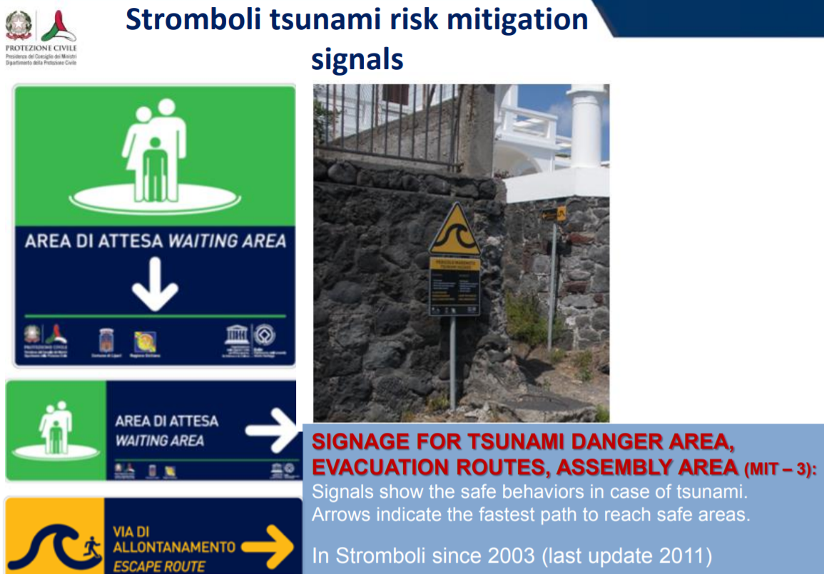
Stromboli, Italy tsunami mitigation and preparedness. Dipartimento della Protezione Civile, Italy.
The UN Ocean Decade Societal challenge on a Safe Ocean and the Tsunami Decade Programme are also focused on addressing the challenges concerning tsunamis from multiple sources (e.g. seismic events, volcanic explosions, coastal and underwater landslides). The ongoing, “Tsunami Ready Pilot Programme”, is an important tool to prepare vulnerable coastal residents to tsunamis, in particular those triggered close to the coast with a very short time to evacuate. In the NEAM region, member states have formally began work towards a Tsunami Ready recognized coastal communities such as Cannes (France), Marzamemi, Minturno, and Palmi (Italy), and Chipiona (Spain). In addition, a new project funded by the European Union Civil Protection and Humanitarian Aid Operations (ECHO), will also support the implementation of Tsunami Ready communities in several countries, including Morocco and Spain (Chipiona).
Education, drills and exercises are key to increase awareness and response of vulnerable communities to tsunami events. The last NEAM tsunami exercise (NEAMWave21) was held on 8-10 March 2021 with the participation of subscribed member states in a joint tsunami scenario conducted by CENALT (France) and IPMA (Portugal) based on the 1755 and magnitude 8.6 Lisbon earthquake and tsunami that had a major impact in Portugal, Morocco and Spain. The IOC/UNESCO and Member States, in collaboration with key partners are fully engaged in reducing sea level related coastal hazard risks, including tsunami through effective and enhanced Tsunami Early Warning and Mitigation System in the NEAM region.
NEAMTIC Resources
![]()
This website was developed with the support of the European Commission Directorate General for Humanitarian Aid and Civil Protection.
Developed by Mediatools
The translations provided are automated by Google Translate and therefore may not be accurate. NEAMTIC will not be responsible for the discrepancies of the translated version of the website.